NOTE: The following summary information is to help with hike selection and is not intended to be used for hiking the trail. For your safety and enjoyment, please obtain a copy of Sedona Hiking Guide which is available here.
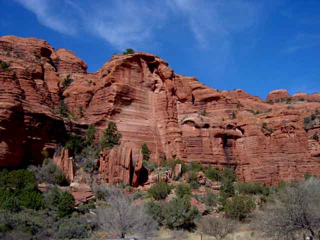
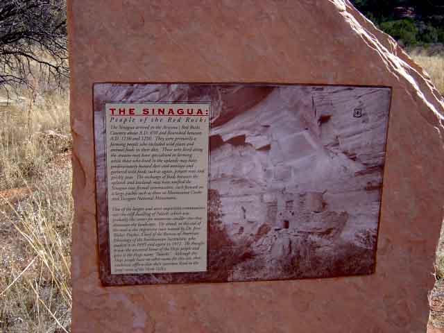
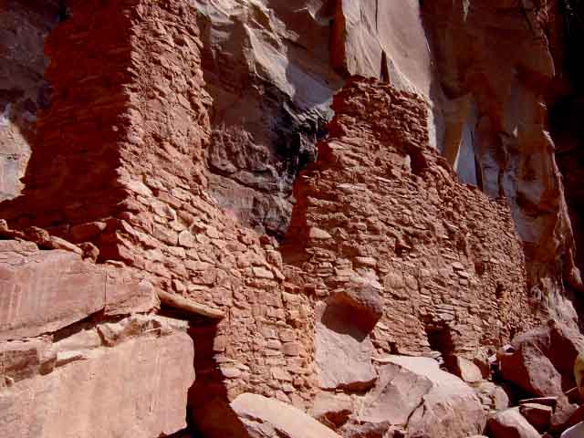
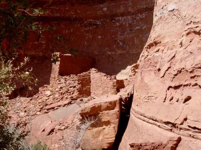
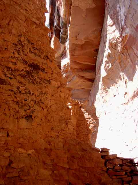
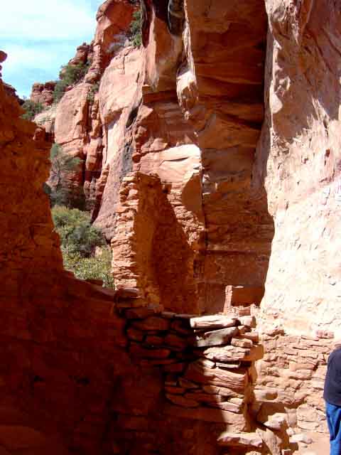
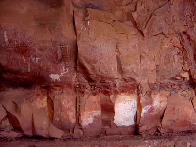
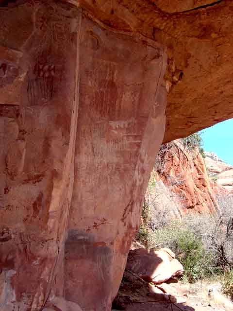
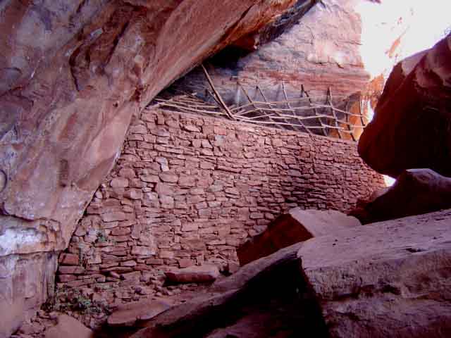
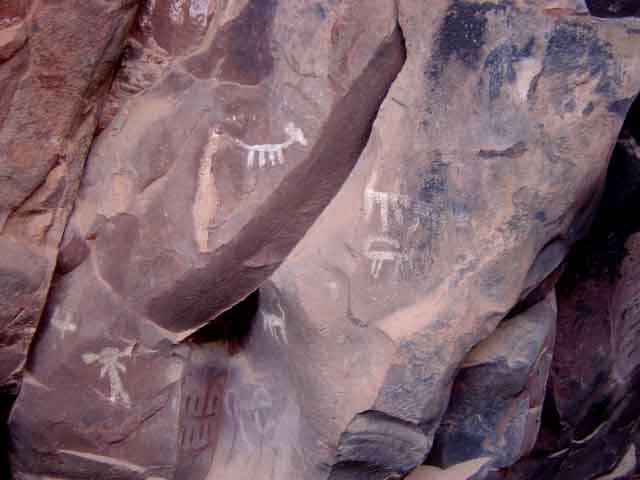
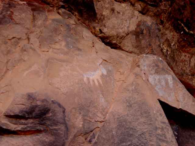
Summary: One of the nicest examples of cliff dwellings of the Sinagua and later Indians in the Sedona area
Challenge Level: Easy
Hiking Distance: About 0.6 miles one way, 1.2 miles round trip to the Ruins; about 0.3 miles one way, 0.6 miles to the Rock Art
Trailhead Location: The parking area is located on FR 795, which can be very rough. A high-clearance vehicle is recommended.
Description: Palatki is now available to visitors on a limited basis. Tours for up to 10 visitors at a time will be conducted every 30 minutes, beginning at 10:00 a.m. Plan to arrive at least 15 minutes before a scheduled tour time. You should call for reservations before arriving (928) 282-3854. Those with reservations will be given first priority to visit the dwellings. There is no cost beyond the cost of a Red Rock Pass. They will ask your last name, how many in your party and which time slot do you want. After you park, walk to the Visitor Center and check in. Then continue down the path and either go right to the Ruins, or left to the Rock Art.

Great Sedona Hikes
Last Updated March 31, 2021
Web Page by Bill Bohan (hikebook@greatsedonahikes.com)
send an email
with your comments/suggestions to Bill