


NOTE: The following summary information is to help with hike selection and is not intended to be used for hiking the trail. For your safety and enjoyment, please obtain a copy of Great Sedona Hikes hiking guide available HERE.
Summary: A hike along the base of Mitten Ridge
Challenge Level: Moderate (and be sure you have hiking boots with good traction)
Hiking Distance: About 2 miles each way, 4 miles round trip
Trailhead Location: The parking area is located on Schnebly Hill Road. Schnebly Hill is paved for the first mile and the road beyond can be a very rough unpaved road. A high-clearance vehicle is strongly recommended.
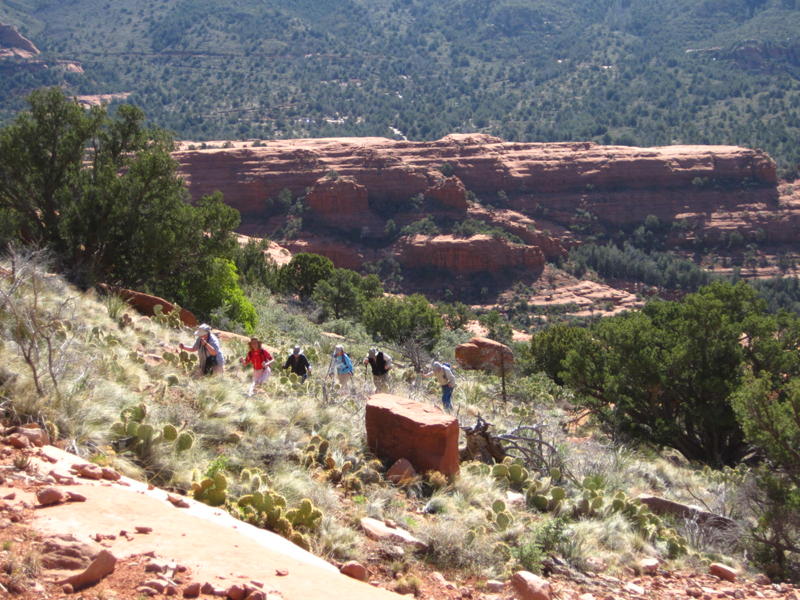
Description: You'll be hiking the Cow Pies Trail for the first 0.3 miles. Instead of turning left to go to Cow Pies, continue straight to the base of Mitten Ridge. The trail is partially marked by foot traffic but you'll have to keep your eyes open to follow the trail in some parts. Also, the trail is very narrow and steep in places with steep drop offs. When you arrive at the saddle, you'll have a nice view of Midgley Bridge and Wilson Mountain in the distance.


For those of you who have a GPS unit, I have GPS data available for the hike which include "tracks," the route and waypoints.
Great Sedona Hikes
Last Updated March 31, 2021
Web Page by Bill Bohan (hikebook@greatsedonahikes.com)
send an email
with your comments/suggestions to Bill
